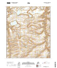
2020 Map of Ikpikpuk River C-1 SE
USGS Topo · Published 2020About this map
Square Lake sits as a central landmark in this remote reach of the North Slope, where the terrain is defined by a dense network of hydrologic features. The landscape is characterized by the meandering courses of Judy Cr and Key Cr, which weave through the survey area. This 2020 map documents the complex drainage patterns of the arctic tundra, showing how water moves through the low-lying reaches of the North Slope Borough. The topographic detail highlights the subtle elevation changes between the creek beds and the surrounding basin, providing a precise record of the regional hydrology and the relative positions of these named water bodies within the vast Alaskan interior.
Find a feature on this map
7 named features on this map. Tap any name to fly to it.
Don’t see what you’re looking for? This feature index may not catch every label — zoom into the map to look around manually.
Map Details
Editions of this 2020 Ikpikpuk River C-1 SE Map
This is the sole edition of this map. No revisions or reprints were ever made.
Other maps of this area

1951 · Ikpikpuk River
USGS Topo · 1:250,000

1952 · Umiat
USGS Topo · 1:250,000

1955 · Umiat C-5
USGS Topo · 1:63,360

1955 · Umiat B-5
USGS Topo · 1:63,360

1956 · Ikpikpuk River
USGS Topo · 1:250,000

1956 · Umiat
USGS Topo · 1:250,000

1964 · Umiat
USGS Topo · 1:250,000
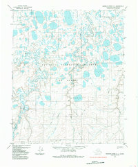
1985 · Ikpikpuk River C-1
USGS Topo · 1:63,360
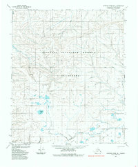
1985 · Ikpikpuk River B-1
USGS Topo · 1:63,360
2013 · Ikpikpuk River B-1 NE
USGS Topo · 1:25,000