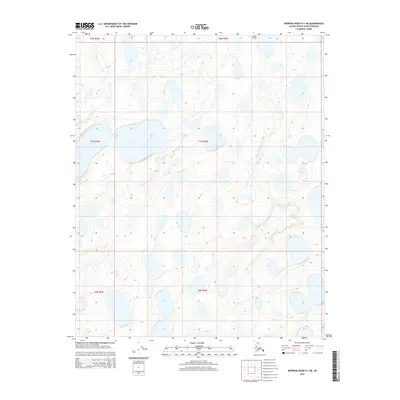
2015 Map of Ikpikpuk River D-1 NE
USGS Topo · Published 2015About this map
Inigok Airport stands as the primary human landmark in this section of the North Slope, situated near the northern edge of the survey area. This remote landscape is defined by an intricate network of thermokarst lakes and the meandering path of Fish Cr, which threads through the permafrost-laden terrain. The map meticulously documents the hydrological patterns of the Alaskan tundra, where the myriad water bodies are separated by subtle topographic rises that rarely exceed fifty feet in elevation. While the region lacks permanent settlements, the inclusion of the airstrip highlights the critical role of aviation in accessing this arctic environment for scientific research and resource management. The structural grid of the Public Land Survey System, including townships such as t8n r5w and t7n r6w, provides the only administrative framework over this vast, unpopulated stretch of the borough.
Find a feature on this map
8 named features on this map. Tap any name to fly to it.
Don’t see what you’re looking for? This feature index may not catch every label — zoom into the map to look around manually.
Map Details
Editions of this 2015 Ikpikpuk River D-1 NE Map
This is the sole edition of this map. No revisions or reprints were ever made.
Other maps of this area

1951 · Harrison Bay
USGS Topo · 1:250,000

1951 · Teshekpuk
USGS Topo · 1:250,000

1951 · Ikpikpuk River
USGS Topo · 1:250,000

1952 · Umiat
USGS Topo · 1:250,000

1955 · Harrison Bay
USGS Topo · 1:250,000

1955 · Teshekpuk
USGS Topo · 1:250,000

1955 · Teshekpuk A-1
USGS Topo · 1:63,360

1955 · Harrison Bay A-5
USGS Topo · 1:63,360
1955 · Umiat D-5
USGS Topo · 1:63,360

1956 · Ikpikpuk River
USGS Topo · 1:250,000