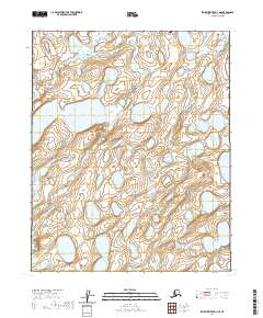
2020 Map of Ikpikpuk River D-1 NE
USGS Topo · Published 2020About this map
Inigok Airport serves as a remote navigational waypoint in the northern reaches of the Alaska North Slope, situated within a vast expanse of wetlands and small lakes. The landscape is defined by the winding course of Fish Cr, which meanders through the central and southern portions of the sheet. This 2020 survey illustrates the characteristic drainage patterns and thermokarst features of the Arctic coastal plain, providing a detailed record of the tundra before seasonal changes or geological shifts alter the waterways. The presence of the landing strip at Inigok highlights the importance of aviation in accessing this roadless territory for environmental monitoring or resource management.
Find a feature on this map
11 named features on this map. Tap any name to fly to it.
Don’t see what you’re looking for? This feature index may not catch every label — zoom into the map to look around manually.
Map Details
Editions of this 2020 Ikpikpuk River D-1 NE Map
This is the sole edition of this map. No revisions or reprints were ever made.
Other maps of this area

1951 · Harrison Bay
USGS Topo · 1:250,000

1951 · Teshekpuk
USGS Topo · 1:250,000

1951 · Ikpikpuk River
USGS Topo · 1:250,000

1952 · Umiat
USGS Topo · 1:250,000

1955 · Harrison Bay
USGS Topo · 1:250,000

1955 · Teshekpuk
USGS Topo · 1:250,000

1955 · Teshekpuk A-1
USGS Topo · 1:63,360

1955 · Harrison Bay A-5
USGS Topo · 1:63,360
1955 · Umiat D-5
USGS Topo · 1:63,360

1956 · Ikpikpuk River
USGS Topo · 1:250,000