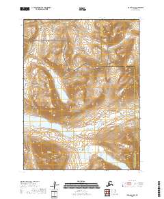
2018 Map of Iliamna A-5 SW
USGS Topo · Published 2018About this map
Katmai National Park and the adjacent Katmai National Preserve define this landscape on the Alaska Peninsula. The map reveals a transition from the elevated peaks of the Walatka Mountains in the southwest to a complex hydrological network of glacial lakes and drainages. Notable water bodies including Iron Springs Lake, Battle Lake, and Pirate Lake dominate the central and southern portions of the quadrangle. These features, along with Moraine Cr and Crevice Cr, suggest a terrain primarily shaped by ancient ice movements and seasonal meltwater. The placement of the Lake and Peninsula and Kenai Peninsula Borough boundary line through this remote wilderness highlights the administrative divisions that persist even in protected conservation lands. This 2018 survey provides a modern look at a region where natural drainage patterns dictate the geography of the Alaskan interior.
Find a feature on this map
14 named features on this map. Tap any name to fly to it.
Don’t see what you’re looking for? This feature index may not catch every label — zoom into the map to look around manually.
Map Details
Editions of this 2018 Iliamna A-5 SW Map
This is the sole edition of this map. No revisions or reprints were ever made.
Other maps of this area

1948 · Mt Katmai
USGS Topo · 1:250,000

1951 · Mt Katmai
USGS Topo · 1:250,000

1951 · Iliamna A-5
USGS Topo · 1:63,360

1951 · Mount Katmai D-3
USGS Topo · 1:63,360

1951 · Iliamna A-6
USGS Topo · 1:63,360

1952 · Iliamna
USGS Topo · 1:250,000

1952 · Iliamna A-5
USGS Topo · 1:63,360

1957 · Iliamna
USGS Topo · 1:250,000

1964 · Mt. Katmai
USGS Topo · 1:250,000
2018 · Iliamna A-5 NW
USGS Topo · 1:25,000