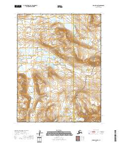
2018 Map of Iliamna A-5 NW
USGS Topo · Published 2018About this map
Katmai National Preserve dominates the central and southern portions of this landscape, where the drainage systems of the Alaska Peninsula shape the high-elevation terrain. The hydrology of the region is defined by glacial waters feeding into Funnel Creek and Moraine Cr, which navigate through the complex contours of the Lake and Peninsula Borough. This wilderness is punctuated by named water bodies such as Mirror Lake and the unusually shaped Spectacle Lake, illustrating the post-glacial topography common in this part of the subarctic. To the east, the headwaters of the N Fork Paint River begin their descent toward the coast, crossing the boundary into the Kenai Peninsula Borough. The map highlights a region devoid of permanent settlements or roads, focusing instead on the hydrographic network and public land survey system lines that delineate these vast government-managed lands.
Find a feature on this map
11 named features on this map. Tap any name to fly to it.
Don’t see what you’re looking for? This feature index may not catch every label — zoom into the map to look around manually.
Map Details
Editions of this 2018 Iliamna A-5 NW Map
This is the sole edition of this map. No revisions or reprints were ever made.
Other maps of this area

1951 · Iliamna A-5
USGS Topo · 1:63,360

1951 · Iliamna B-5
USGS Topo · 1:63,360

1951 · Iliamna B-6
USGS Topo · 1:63,360

1951 · Iliamna A-6
USGS Topo · 1:63,360

1952 · Iliamna
USGS Topo · 1:250,000

1952 · Iliamna A-5
USGS Topo · 1:63,360
1954 · Iliamna B-5
USGS Topo · 1:63,360
1954 · Iliamna B-6
USGS Topo · 1:63,360

1957 · Iliamna
USGS Topo · 1:250,000
2018 · Iliamna A-5 SE
USGS Topo · 1:25,000