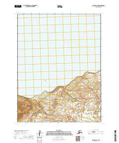
2019 Map of Iliamna B-6 NE
USGS Topo · Published 2019About this map
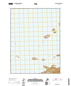
Iliamna Lake dominates the upper half of this 2019 survey, representing the massive freshwater expanse that characterizes the northern reach of the Alaska Peninsula. The southern shoreline transitions from the open water of the lake into a landscape defined by the drainage of Dennis Cr. This terrain, situated within the Lake and Peninsula Borough, showcases the transition between large-scale lacustrine environments and the immediate topographical rise of the surrounding lands. Grounded in data from the National Hydrography Dataset and National Elevation Dataset, the map illustrates the precise interface of water and shore in an area defined by its significant township and range boundaries, such as t9s r34w and t8s r33w.
Find a feature on this map
6 named features on this map. Tap any name to fly to it.
Don’t see what you’re looking for? This feature index may not catch every label — zoom into the map to look around manually.
Map Details
Editions of this 2019 Iliamna B-6 NE Map
This is the sole edition of this map. No revisions or reprints were ever made.
Other maps of this area

1951 · Iliamna B-5
USGS Topo · 1:63,360

1951 · Iliamna B-6
USGS Topo · 1:63,360

1952 · Iliamna
USGS Topo · 1:250,000

1954 · Iliamna C-6
USGS Topo · 1:63,360

1954 · Iliamna C-5
USGS Topo · 1:63,360
1954 · Iliamna B-5
USGS Topo · 1:63,360
1954 · Iliamna B-6
USGS Topo · 1:63,360

1957 · Iliamna
USGS Topo · 1:250,000
2018 · Iliamna B-5 NW
USGS Topo · 1:25,000
2018 · Iliamna C-5 SW
USGS Topo · 1:25,000