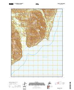
2018 Map of Iliamna C-1 NE
USGS Topo · Published 2018About this map
Chinitna Point projects into the Pacific Ocean on this coastal segment of the Kenai Peninsula, marking a transition from the marine environment to the foothills of the Aleutian Range. The landscape is defined by its drainage systems, with numerous small waterways such as Blister Cr, Griffin Cr, and Rich Cr flowing toward the coast. The shoreline is characterized by the wide indentation of Dry Bay, where tidal flats and low-lying coastal terrain meet the steeper elevations of the interior. Further inland, the topography rises toward Knub Hill, providing a detailed look at the hydrology and relief of this unpopulated coastal stretch. The map documents the natural state of the shoreline before the end of the second decade of the 21st century, showing the intricate interplay of Brown Cr and Bow Cr as they navigate the coastal plains.
Find a feature on this map
14 named features on this map. Tap any name to fly to it.
Don’t see what you’re looking for? This feature index may not catch every label — zoom into the map to look around manually.
Map Details
Editions of this 2018 Iliamna C-1 NE Map
This is the sole edition of this map. No revisions or reprints were ever made.
Other maps of this area

1949 · Iliamna C-1
USGS Topo · 1:63,360

1951 · Seldovia
USGS Topo · 1:250,000

1952 · Iliamna
USGS Topo · 1:250,000

1957 · Iliamna
USGS Topo · 1:250,000

1958 · Iliamna D-1
USGS Topo · 1:63,360

1958 · Iliamna C-1
USGS Topo · 1:63,360
1958 · Seldovia D-8
USGS Topo · 1:63,360

1963 · Seldovia
USGS Topo · 1:250,000
2018 · Iliamna D-1 SW
USGS Topo · 1:25,000
2018 · Iliamna D-1 SE
USGS Topo · 1:25,000