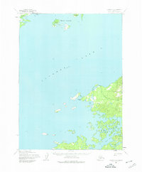
1954 Map of Iliamna C-5
USGS Topo · Published 1975About this map
Seversens and a cluster of Cabins mark the northern shore of Iliamna Lake in this mid-1950s survey. The landscape is defined by the complex, jagged shoreline of the lake's southeastern reaches, particularly around the many-isled waters of Intricate Bay and Snug Harbor. This area reflects a remote Alaskan wilderness where transportation was dictated by water and topography rather than roads, as evidenced by the lack of overland routes connecting the scattered points of habitation.
Find a feature on this map
16 named features on this map. Tap any name to fly to it.
Don’t see what you’re looking for? This feature index may not catch every label — zoom into the map to look around manually.
Map Details
Editions of this 1954 Iliamna C-5 Map
2 editions found
Other maps of this area

1951 · Iliamna B-5
USGS Topo · 1:63,360

1951 · Iliamna B-6
USGS Topo · 1:63,360

1952 · Iliamna
USGS Topo · 1:250,000

1954 · Iliamna C-6
USGS Topo · 1:63,360

1954 · Iliamna C-5
USGS Topo · 1:63,360

1954 · Iliamna D-4
USGS Topo · 1:63,360

1954 · Iliamna C-4
USGS Topo · 1:63,360

1954 · Iliamna B-4
USGS Topo · 1:63,360

1954 · Iliamna D-5
USGS Topo · 1:63,360
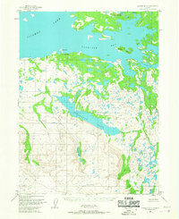
1954 · Iliamna B-5
USGS Topo · 1:63,360