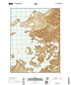
2018 Map of Iliamna C-5 SE
USGS Topo · Published 2018About this map
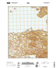
Iliamna Lake dominates this coastal landscape, where the vast freshwater body meets a complex network of inlets and river systems. This 2018 survey detail shows the intricate shoreline along Intricate Bay and Leon Bay, areas defined by their proximity to the deep indentations of the coastline. The terrain is characterized by low-lying wetlands and scattered water bodies, including the Pike Lakes near the southern margin. The Copper River empties into the sheltered Copper River Bay, illustrating the important drainage patterns of this sub-arctic environment. Tommy Point and the mouth of Tommy Cr mark the northern reaches of the sheet, providing specific landmarks in an area otherwise notable for its lack of established roads or permanent settlements.
Find a feature on this map
14 named features on this map. Tap any name to fly to it.
Don’t see what you’re looking for? This feature index may not catch every label — zoom into the map to look around manually.
Map Details
Editions of this 2018 Iliamna C-5 SE Map
This is the sole edition of this map. No revisions or reprints were ever made.
Other maps of this area

1951 · Iliamna B-5
USGS Topo · 1:63,360

1952 · Iliamna
USGS Topo · 1:250,000

1954 · Iliamna C-5
USGS Topo · 1:63,360

1954 · Iliamna C-4
USGS Topo · 1:63,360

1954 · Iliamna B-4
USGS Topo · 1:63,360
1954 · Iliamna B-5
USGS Topo · 1:63,360

1957 · Iliamna
USGS Topo · 1:250,000
2018 · Iliamna C-5 NW
USGS Topo · 1:25,000
2018 · Iliamna B-5 NE
USGS Topo · 1:25,000
2018 · Iliamna B-5 NW
USGS Topo · 1:25,000