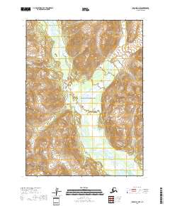
2018 Map of Iliamna D-1 NW
USGS Topo · Published 2018About this map
Lake Clark National Park encompasses this portion of the Kenai Peninsula, where a complex network of glacial meltwater defines the drainage patterns. The topographic detail focuses on the confluence of the Left Fork West Glacier Creek and Right Fork West Glacier Creek as they merge into the main channel of West Glacier Creek. This hydrological system is further supported by numerous tributaries including Holland Cr, Toole Cr, and Silver Salmon Cr.
Find a feature on this map
14 named features on this map. Tap any name to fly to it.
Don’t see what you’re looking for? This feature index may not catch every label — zoom into the map to look around manually.
Map Details
Editions of this 2018 Iliamna D-1 NW Map
This is the sole edition of this map. No revisions or reprints were ever made.
Other maps of this area

1946 · Lake Clark
USGS Topo · 1:250,000

1951 · Lake Clark
USGS Topo · 1:250,000

1952 · Iliamna
USGS Topo · 1:250,000

1957 · Iliamna
USGS Topo · 1:250,000

1958 · Iliamna D-2
USGS Topo · 1:63,360

1958 · Iliamna D-1
USGS Topo · 1:63,360

1958 · Lake Clark A-1
USGS Topo · 1:63,360
1958 · Lake Clark A-2
USGS Topo · 1:63,360

1958 · Lake Clark
USGS Topo · 1:250,000
2018 · Iliamna D-1 SW
USGS Topo · 1:25,000