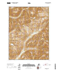
2018 Map of Iliamna D-2 NE
USGS Topo · Published 2018About this map
Lake Clark National Park occupies much of this Alaskan interior landscape, where high-elevation terrain is defined by steep glacial valleys and seasonal drainages. The Iliamna River and Iniskin River flow through the southern sections of the quadrangle, serving as primary conduits for the region's hydrologic network. The absence of roads or permanent structures reflects the protected and primitive state of the wilderness in this part of the Kenai Peninsula Borough. Small tributaries such as Holland Cr carve through the northern ranges, illustrating the complex drainage patterns that shape the local topography. This 2018 survey provides a clear view of the natural boundaries and surveyed townships including t2s r25w and t3s r24w that divide this remote northern territory.
Find a feature on this map
8 named features on this map. Tap any name to fly to it.
Don’t see what you’re looking for? This feature index may not catch every label — zoom into the map to look around manually.
Map Details
Editions of this 2018 Iliamna D-2 NE Map
This is the sole edition of this map. No revisions or reprints were ever made.
Other maps of this area

1946 · Lake Clark
USGS Topo · 1:250,000

1951 · Lake Clark
USGS Topo · 1:250,000

1952 · Iliamna
USGS Topo · 1:250,000

1957 · Iliamna
USGS Topo · 1:250,000

1958 · Iliamna D-2
USGS Topo · 1:63,360

1958 · Iliamna D-1
USGS Topo · 1:63,360

1958 · Lake Clark A-1
USGS Topo · 1:63,360
1958 · Lake Clark A-2
USGS Topo · 1:63,360

1958 · Lake Clark
USGS Topo · 1:250,000
2018 · Iliamna D-1 SW
USGS Topo · 1:25,000