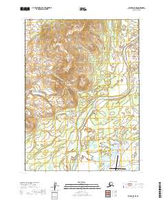
2019 Map of Iliamna D-6 SE
USGS Topo · Published 2019About this map
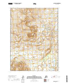
The Newhalen River carves a central path through this landscape, creating a vital corridor between the mountainous northern heights and the flatter lake-dotted terrain to the south. In the north, the elevation is anchored by Taq' Nust'in Mtn, while the river downstream reaches Petrof Falls. The southern portion of the map reveals the modern infrastructure of the Lake and Peninsula Borough, centered around the Iliamna Airport. This area is characterized by a network of local transit including the Iliamna-Nondalton/Newhalen River Road and Old Newhalen River Road, which likely reflect the historical and contemporary movement of goods and people between local communities. Numerous water features like Pike Lake and Pete Andrews Cr emphasize the importance of the watershed to this part of Alaska.
Find a feature on this map
20 named features on this map. Tap any name to fly to it.
Don’t see what you’re looking for? This feature index may not catch every label — zoom into the map to look around manually.
Map Details
Editions of this 2019 Iliamna D-6 SE Map
This is the sole edition of this map. No revisions or reprints were ever made.
Other maps of this area

1952 · Iliamna
USGS Topo · 1:250,000

1954 · Iliamna C-6
USGS Topo · 1:63,360

1954 · Iliamna C-5
USGS Topo · 1:63,360

1954 · Iliamna D-5
USGS Topo · 1:63,360
1954 · Iliamna D-6
USGS Topo · 1:63,360

1957 · Iliamna
USGS Topo · 1:250,000
2018 · Iliamna D-5 NW
USGS Topo · 1:25,000

2018 · Iliamna C-5 NW
USGS Topo · 1:25,000
2018 · Iliamna D-5 SW
USGS Topo · 1:25,000
2019 · Iliamna D-6 NW
USGS Topo · 1:25,000