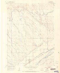
1951 Map of Iliff
USGS Topo · Published 1953About this map
The South Platte River corridor near Iliff is defined by an intricate network of irrigation systems developed for the Missouri River Basin. This 1951 topographic survey reveals the extensive water management infrastructure of Logan County, including the Sterling Outlet Canal, the North Sterling Outlet Canal, and various laterals like No 26 Gillette Ditch. The presence of Selma (Aban'd) along the Union Pacific rail line highlights a shifting settlement pattern as early railroad stops were eclipsed by the growth of nearby agricultural centers. The landscape transition from the river bottom to the uplands is marked by drainage features such as Trap Draw and Lewis Creek, while smaller water bodies like McKenzie Pond and Larson Pond appear amidst the surveyed section lines. This map serves as a detailed record of the mid-century engineering required to sustain plains farming.
Find a feature on this map
29 named features on this map. Tap any name to fly to it.
Don’t see what you’re looking for? This feature index may not catch every label — zoom into the map to look around manually.
Map Details
Editions of this 1951 Iliff Map
3 editions found
Other maps of this area

1951 · Sterling North
USGS Topo · 1:24,000

1951 · Galien
USGS Topo · 1:24,000

1951 · Iliff
USGS Topo · 1:24,000

1951 · Padroni NW
USGS Topo · 1:24,000

1952 · Padroni
USGS Topo · 1:24,000

1953 · Peetz
USGS Topo · 1:24,000

1953 · Proctor
USGS Topo · 1:24,000

1953 · Haystack Butte
USGS Topo · 1:24,000

1954 · Sterling
USGS Topo · 1:250,000

1958 · Sterling
USGS Topo · 1:250,000