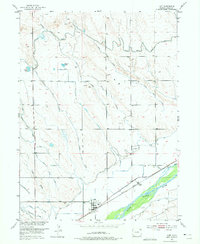
1951 Map of Iliff
USGS Topo · Published 1975About this map
Iliff serves as the focal point of this Logan County landscape, situated along the northern banks of the South Platte River and the corridor of the Union Pacific railroad. The map documents a sophisticated agricultural irrigation network vital to the High Plains, featuring an extensive system of laterals and ditches such as the Sterling Outlet Canal, Iliff Ditch, and Valley Ditch.
Find a feature on this map
27 named features on this map. Tap any name to fly to it.
Don’t see what you’re looking for? This feature index may not catch every label — zoom into the map to look around manually.
Map Details
Editions of this 1951 Iliff Map
3 editions found
Other maps of this area

1951 · Sterling North
USGS Topo · 1:24,000

1951 · Galien
USGS Topo · 1:24,000

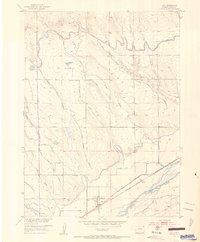
1951 · Iliff
USGS Topo · 1:24,000

1951 · Padroni NW
USGS Topo · 1:24,000

1952 · Padroni
USGS Topo · 1:24,000

1953 · Peetz
USGS Topo · 1:24,000

1953 · Proctor
USGS Topo · 1:24,000

1953 · Haystack Butte
USGS Topo · 1:24,000

1954 · Sterling
USGS Topo · 1:250,000

1958 · Sterling
USGS Topo · 1:250,000