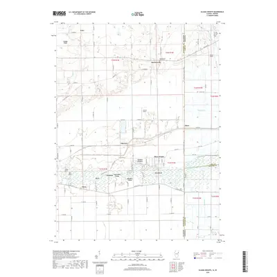
2018 Map of Illiana Heights
USGS Topo · Published 2018About this map
The Kankakee River dominates the lower half of this landscape, winding through a complex of wetlands and low-lying points such as Essigs Point and Vails Island. This river corridor is dotted with small riverfront settlements and recreational outposts, including Log Cabin Camp, Shadow Lawn, and the small clusters of Woodland and Ahern. The hydrology of the region is highly modified by an extensive network of drainage features like Singleton Ditch, Williams Ditch, and Best Ditch, which manage the water levels for the surrounding agricultural lands.
Find a feature on this map
90 named features on this map. Tap any name to fly to it.
Don’t see what you’re looking for? This feature index may not catch every label — zoom into the map to look around manually.
Map Details
Editions of this 2018 Illiana Heights Map
This is the sole edition of this map. No revisions or reprints were ever made.
Other maps of this area

1922 · Momence
USGS Topo · 1:62,500

1924 · Momence
USGS Topo · 1:62,500

1949 · Crete
USGS Topo · 1:62,500

1953 · Beecher West
USGS Topo · 1:24,000

1953 · Beecher East
USGS Topo · 1:24,000

1953 · Lowell
USGS Topo · 1:24,000

1953 · Chicago
USGS Topo · 1:250,000

1957 · Chicago
USGS Topo · 1:250,000

1959 · Schneider
USGS Topo · 1:24,000
1959 · Momence NE
USGS Topo · 1:24,000