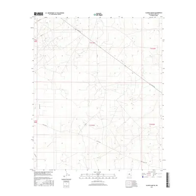
2017 Map of Illinois Camp NE
USGS Topo · Published 2017About this map
The vast, arid plains of Eddy County are defined by a network of ranching and access roads in this 2017 survey. Bluestem Rd cuts diagonally across the landscape, serving as a primary artery through the township and range sections. The nomenclature of the area reflects its pastoral and agricultural character, with thoroughfares such as Cowtown Rd, Horse Shoe Rd, Curry Comb Rd, and Buckskin Rd marking the terrain. The map captures the systematic division of the land into distinct quadrants like t18s r29e and t19s r29e, revealing a modern rural infrastructure focused on land management and resource transport. This cartographic study provides an essential look at the late 20th-century development of New Mexico's southeastern rangelands.
Find a feature on this map
13 named features on this map. Tap any name to fly to it.
Don’t see what you’re looking for? This feature index may not catch every label — zoom into the map to look around manually.
Map Details
Editions of this 2017 Illinois Camp NE Map
This is the sole edition of this map. No revisions or reprints were ever made.
Other maps of this area
1942 · Clayton Basin
USGS Topo · 1:62,500
1943 · Clayton Basin
USGS Topo · 1:62,500
1943 · Oil City
USGS Topo · 1:62,500

1954 · Carlsbad
USGS Topo · 1:250,000

1954 · Hobbs
USGS Topo · 1:250,000
1955 · Red Lake SE
USGS Topo · 1:24,000
1955 · Red Lake
USGS Topo · 1:24,000

1958 · Carlsbad
USGS Topo · 1:250,000

1958 · Hobbs
USGS Topo · 1:250,000
1963 · Maljamar
USGS Topo · 1:62,500