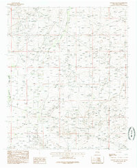
1985 Map of Illinois Camp NE
USGS Topo · Published 1985About this map
Bear Grass Draw and Palmilla Draw dominate this portion of the New Mexico landscape as it was documented in the mid-1970s and 1980s. The terrain is characterized by these ephemeral watercourses and a sparse industrial presence, notably a Gravel Pit located in the southern portion of the survey. The map reveals an area defined by extensive utility infrastructure, with multiple Pipeline routes traversing the region, suggesting the importance of energy transport in this part of Eddy County. Produced from original manuscript drawings and field-checked in 1978, this provisional survey provides a precise view of the arid landscape and its resource-driven modifications during a period of modern industrial expansion.
Find a feature on this map
5 named features on this map. Tap any name to fly to it.
Don’t see what you’re looking for? This feature index may not catch every label — zoom into the map to look around manually.
Map Details
Editions of this 1985 Illinois Camp NE Map
This is the sole edition of this map. No revisions or reprints were ever made.
Other maps of this area

1942 · Clayton Basin
USGS Topo · 1:62,500

1943 · Clayton Basin
USGS Topo · 1:62,500

1943 · Oil City
USGS Topo · 1:62,500

1954 · Carlsbad
USGS Topo · 1:250,000

1954 · Hobbs
USGS Topo · 1:250,000

1955 · Red Lake SE
USGS Topo · 1:24,000

1955 · Red Lake
USGS Topo · 1:24,000

1958 · Carlsbad
USGS Topo · 1:250,000

1958 · Hobbs
USGS Topo · 1:250,000

1963 · Maljamar
USGS Topo · 1:62,500