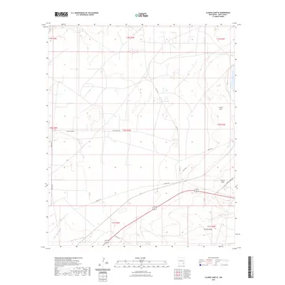
2023 Map of Illinois Camp SE
USGS Topo · Published 2023About this map
Clayton Basin defines the northeastern portion of this Eddy County landscape, where the Chihuahuan Desert terrain is marked by distinct topographic rises and drainage patterns. The industrial and utility character of the region is evident through the network of specialized thoroughfares, including Potash Mines Rd and Landfill Rd, which serve the local resource extraction and infrastructure needs. Elevation changes are anchored by Mimosa Ridge and Quahada Ridge in the southeast, while intermittent watercourses like Fenton Draw and Lone Tree Draw cut through the arid plains. These features, alongside long-established routes such as Buckeye Rd and Burton Flats Rd, illustrate the intersection of modern transport and natural landforms in the Delaware Basin.
Find a feature on this map
20 named features on this map. Tap any name to fly to it.
Don’t see what you’re looking for? This feature index may not catch every label — zoom into the map to look around manually.
Map Details
Editions of this 2023 Illinois Camp SE Map
This is the sole edition of this map. No revisions or reprints were ever made.
Other maps of this area

1939 · Carlsbad
USGS Topo · 1:62,500

1939 · Nash Draw
USGS Topo · 1:62,500

1942 · Clayton Basin
USGS Topo · 1:62,500

1943 · Carlsbad
USGS Topo · 1:62,500

1943 · Clayton Basin
USGS Topo · 1:62,500

1943 · Oil City
USGS Topo · 1:62,500

1943 · Nash Draw
USGS Topo · 1:62,500

1954 · Carlsbad
USGS Topo · 1:250,000

1954 · Hobbs
USGS Topo · 1:250,000

1958 · Carlsbad
USGS Topo · 1:250,000