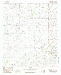
1985 Map of Illinois Camp SE
USGS Topo · Published 1985About this map
The Oil Field dominates the central landscape of this Eddy County survey, reflecting the intensive industrial footprint of the Permian Basin during the mid-1980s. The terrain is defined by a series of prominent topographic rises and depressions, including Burton Flat and the expansive Clayton Basin to the east. These geological features are flanked by Mimosa Ridge and Quahada Ridge, where the map identifies several mine shafts and a gravel pit that point to the area's multifaceted extraction history.
Find a feature on this map
13 named features on this map. Tap any name to fly to it.
Don’t see what you’re looking for? This feature index may not catch every label — zoom into the map to look around manually.
Map Details
Editions of this 1985 Illinois Camp SE Map
This is the sole edition of this map. No revisions or reprints were ever made.
Other maps of this area

1939 · Carlsbad
USGS Topo · 1:62,500

1939 · Nash Draw
USGS Topo · 1:62,500

1942 · Clayton Basin
USGS Topo · 1:62,500

1943 · Carlsbad
USGS Topo · 1:62,500

1943 · Clayton Basin
USGS Topo · 1:62,500

1943 · Oil City
USGS Topo · 1:62,500

1943 · Nash Draw
USGS Topo · 1:62,500

1954 · Carlsbad
USGS Topo · 1:250,000

1954 · Hobbs
USGS Topo · 1:250,000

1958 · Carlsbad
USGS Topo · 1:250,000