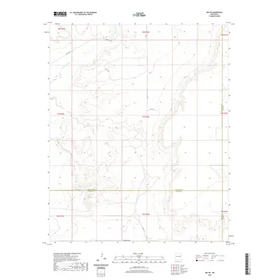
2020 Map of Ima SW
USGS Topo · Published 2020About this map
Alamogordo Cr and Arroyo de Anil carve through this landscape at the intersection of Guadalupe, De Baca, and Quay counties. The terrain is defined by drainage patterns like Jackson Draw and Arroyo Colorado, which highlight the arid hydrological network of eastern New Mexico.
Find a feature on this map
21 named features on this map. Tap any name to fly to it.
Don’t see what you’re looking for? This feature index may not catch every label — zoom into the map to look around manually.
Map Details
Editions of this 2020 Ima SW Map
This is the sole edition of this map. No revisions or reprints were ever made.
Other maps of this area

1954 · Fort Sumner
USGS Topo · 1:250,000

1958 · Fort Sumner
USGS Topo · 1:250,000

1964 · Canada Colorado
USGS Topo · 1:24,000
1964 · Salt Lake
USGS Topo · 1:24,000

1966 · Colorado Canyon
USGS Topo · 1:24,000

1968 · Hassell
USGS Topo · 1:24,000

1968 · Twin Mesa NW
USGS Topo · 1:24,000

1968 · Ima SE
USGS Topo · 1:24,000
1968 · Ima NW
USGS Topo · 1:24,000
1968 · Ima SW
USGS Topo · 1:24,000