
1966 Map of Colorado Canyon
USGS Topo · Published 1969About this map
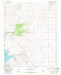
Alamogordo Reservoir dominates the western edge of this mid-1960s landscape, where the Pecos River valley transitions into the arid mesas of eastern New Mexico. The map records the Normal Pool Elevation 4275 along a shoreline shaped by the influx of Alamogordo Creek and the drainage of Arroyo Potrillo. This is a sparsely settled ranching territory defined by the winding path of Colorado Canyon and the administrative boundary between Guadalupe and De Baca counties.
Find a feature on this map
9 named features on this map. Tap any name to fly to it.
Don’t see what you’re looking for? This feature index may not catch every label — zoom into the map to look around manually.
Map Details
Editions of this 1966 Colorado Canyon Map
2 editions found
Other maps of this area

1954 · Fort Sumner
USGS Topo · 1:250,000

1958 · Fort Sumner
USGS Topo · 1:250,000

1964 · Canada Colorado
USGS Topo · 1:24,000

1964 · Fallon Ranch
USGS Topo · 1:24,000

1965 · Windmill Draw
USGS Topo · 1:24,000

1966 · Gibbons Ranch
USGS Topo · 1:24,000

1966 · Alamogordo Dam
USGS Topo · 1:24,000

1968 · Twin Mesa NW
USGS Topo · 1:24,000

1968 · Twin Mesa
USGS Topo · 1:24,000
1968 · Ima SW
USGS Topo · 1:24,000