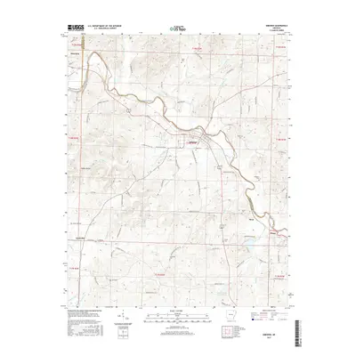
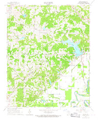
2017 Map of Imboden
USGS Topo · Published 2017About this map
The Spring River winds through the heart of the Ozark foothills, defining the geography of Lawrence and Randolph counties during this 2017 survey. The town of Imboden serves as the primary hub, situated where the river makes a sharp bend, while the smaller settlement of Ravenden marks the northwestern corner of the quadrangle. The map documents a rural landscape where family and community history is preserved through numerous burial grounds, such as Hope Cem, Janes Cem, and Holobaugh Cem. In the southern reaches, Doctor Ralph Joseph Lake and Clear Spring suggest a landscape defined by significant water resources. The terrain is characterized by intricate drainage patterns like Harding Cr and Yeager Hollow, with the Black River appearing at the eastern edge. This detailed study captures the modern road network, including Yeager Hollow Rd and S Riverside Dr, illustrating how 21st-century infrastructure follows the natural contours of the river valleys.
Find a feature on this map
95 named features on this map. Tap any name to fly to it.
Don’t see what you’re looking for? This feature index may not catch every label — zoom into the map to look around manually.
Map Details
Editions of this 2017 Imboden Map
This is the sole edition of this map. No revisions or reprints were ever made.
Other maps of this area

1934 · Powhatan
USGS Topo · 1:62,500

1935 · Powhatan
USGS Topo · 1:62,500

1957 · Poplar Bluff
USGS Topo · 1:250,000

1959 · Poplar Bluff
USGS Topo · 1:250,000

1960 · Poplar Bluff
USGS Topo · 1:250,000
1965 · Smithville
USGS Topo · 1:24,000

1966 · Ravenden Springs
USGS Topo · 1:24,000
1966 · Ravenden Springs SE
USGS Topo · 1:24,000
1966 · Imboden
USGS Topo · 1:24,000
1966 · Eaton
USGS Topo · 1:24,000