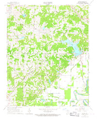
1966 Map of Eaton
USGS Topo · Published 1967About this map
The Strawberry River and the Black River converge in this corner of Northeast Arkansas, defining a landscape of low-lying wetlands and upland ridges during the mid-1960s. The small settlements of Eaton and Denton serve as the primary community hubs, surrounded by a dense network of country churches such as New Hope Ch and Oak Grove Ch. Water dominates the eastern half of the map, where the sprawling Lake Charles is constrained by a spillway near the Black River bottomlands.
Find a feature on this map
31 named features on this map. Tap any name to fly to it.
Don’t see what you’re looking for? This feature index may not catch every label — zoom into the map to look around manually.
Map Details
Editions of this 1966 Eaton Map
2 editions found
Other maps of this area

1932 · Strawberry
USGS Topo · 1:62,500

1934 · Powhatan
USGS Topo · 1:62,500

1935 · Powhatan
USGS Topo · 1:62,500

1935 · Alicia
USGS Topo · 1:62,500

1935 · Strawberry
USGS Topo · 1:62,500

1941 · Strawberry
USGS Topo · 1:62,500

1953 · Memphis
USGS Topo · 1:250,000

1955 · Strawberry
USGS Topo · 1:24,000

1956 · Memphis
USGS Topo · 1:250,000

1957 · Poplar Bluff
USGS Topo · 1:250,000