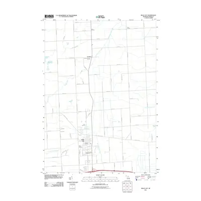
2011 Map of Imlay City
USGS Topo · Published 2011About this map
Imlay City serves as the focal point of this Lapeer County landscape, situated at the crossroads of regional transit and local agriculture. The town's grid expands southward toward the Eastern Michigan Fairgrounds and the North Branch Belle River, while the northern portion of the quadrangle is dominated by the rural settlement of Goodland. This area is particularly rich for genealogical research, documenting several distinct burial grounds including Mount Calvary Cemetery, Imlay Cemetery, and the Indian Cemetery located near Kohler RD. The drainage patterns of the thumb region are well-defined here, showing the headwaters and tributaries of Stony Creek and the North Branch Mill Creek as they weave through a patchwork of family-named roads and section lines. Small glacial features like Pickerel Lake and Bass Lake remain preserved in the western reaches, contrasting with the engineered drainage of the Brinker Drain to the south.
Find a feature on this map
75 named features on this map. Tap any name to fly to it.
Don’t see what you’re looking for? This feature index may not catch every label — zoom into the map to look around manually.
Map Details
Editions of this 2011 Imlay City Map
This is the sole edition of this map. No revisions or reprints were ever made.
Other maps of this area

1914 · Armada
USGS Topo · 1:62,500

1928 · Armada
USGS Topo · 1:62,500

1945 · Almont
USGS Topo · 1:24,000

1945 · Allenton
USGS Topo · 1:24,000

1945 · Thornville
USGS Topo · 1:24,000

1952 · Allenton
USGS Topo · 1:24,000

1954 · Detroit
USGS Topo · 1:250,000

1954 · Flint
USGS Topo · 1:250,000

1958 · Flint
USGS Topo · 1:250,000

1961 · Brown City
USGS Topo · 1:24,000