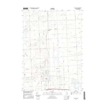
2017 Map of Imlay City
USGS Topo · Published 2017About this map
Imlay City and the village of Attica anchor this 2017 survey of eastern Lapeer County, Michigan. The landscape is defined by an intricate network of agricultural and natural waterways, including the Belle River and its branches, alongside numerous engineered channels like the Wilkie Drain and Hunt Drain. This drainage system illustrates the area's conversion from glacial wetlands into productive farmland. For those tracing family histories, the map identifies several local burial grounds, such as Imlay Cem, Mount Calvary Cem, and the Goodland Township Cem. The Polly Ann State Trail cuts diagonally across the township, following a historic railway corridor that once linked these rural communities. Northwest of the main settlements, Bass Lake and Pickerel Lake provide a glimpse into the original lake-dotted topography of the region before the extensive development of the surrounding drain network.
Find a feature on this map
78 named features on this map. Tap any name to fly to it.
Don’t see what you’re looking for? This feature index may not catch every label — zoom into the map to look around manually.
Map Details
Editions of this 2017 Imlay City Map
This is the sole edition of this map. No revisions or reprints were ever made.
Other maps of this area

1914 · Armada
USGS Topo · 1:62,500

1928 · Armada
USGS Topo · 1:62,500

1945 · Almont
USGS Topo · 1:24,000

1945 · Allenton
USGS Topo · 1:24,000

1945 · Thornville
USGS Topo · 1:24,000

1952 · Allenton
USGS Topo · 1:24,000

1954 · Detroit
USGS Topo · 1:250,000

1954 · Flint
USGS Topo · 1:250,000

1958 · Flint
USGS Topo · 1:250,000

1961 · Brown City
USGS Topo · 1:24,000