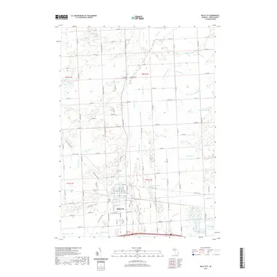
2019 Map of Imlay City
USGS Topo · Published 2019About this map
Imlay City serves as the focal point of this Lapeer County landscape, where the urban grid meets an extensive network of agricultural drainage systems. The town’s history is anchored by Mount Calvary Cem and Imlay Cem, while the surrounding rural townships are dotted with family and municipal burial grounds such as Stuart Cem and Goodland Township Cem. This 2019 survey reveals a terrain defined by its water management, featuring a dense web of named drains like Wilkie Drain, Pennell Drain, and Black Segate Reid Drain that support the local farm economy. Natural waterways including the N Br Belle River and Stony Cr weave between these man-made channels, while Bass Lake and Pickere Lake provide distinct geographic landmarks in the northwestern corner of the quadrangle.
Find a feature on this map
80 named features on this map. Tap any name to fly to it.
Don’t see what you’re looking for? This feature index may not catch every label — zoom into the map to look around manually.
Map Details
Editions of this 2019 Imlay City Map
This is the sole edition of this map. No revisions or reprints were ever made.
Other maps of this area

1914 · Armada
USGS Topo · 1:62,500

1928 · Armada
USGS Topo · 1:62,500

1945 · Almont
USGS Topo · 1:24,000

1945 · Allenton
USGS Topo · 1:24,000

1945 · Thornville
USGS Topo · 1:24,000

1952 · Allenton
USGS Topo · 1:24,000

1954 · Detroit
USGS Topo · 1:250,000

1954 · Flint
USGS Topo · 1:250,000

1958 · Flint
USGS Topo · 1:250,000

1961 · Brown City
USGS Topo · 1:24,000