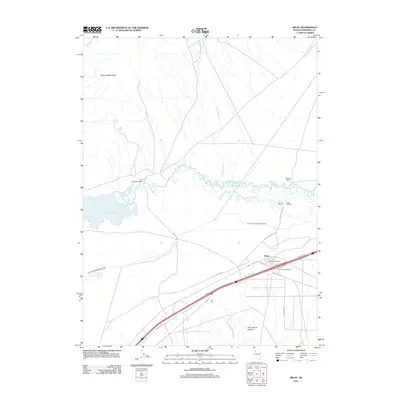
2011 Map of Imlay
USGS Topo · Published 2011About this map
The Humboldt River snakes through the center of this high-desert landscape, defining the water-dependent settlement patterns of this corner of Pershing County. In the settlement of Imlay, the Imlay Post Office and Imlay Interchange serve as a focal point for modern transit, while the historical Old Idaho Stage Rd hints at earlier travel routes through the region. Water management is a dominant theme of the geography, visible in the sprawling Rye Patch Reservoir and the extensive Pitt-Taylor Diversion Canal that cuts across the valley floor.
Find a feature on this map
23 named features on this map. Tap any name to fly to it.
Don’t see what you’re looking for? This feature index may not catch every label — zoom into the map to look around manually.
Map Details
Editions of this 2011 Imlay Map
This is the sole edition of this map. No revisions or reprints were ever made.
Other maps of this area

1931 · Lovelock
USGS Topo · 1:250,000

1935 · Lovelock
USGS Topo · 1:250,000

1939 · Eugene Mountains Area
USGS Topo · 1:62,500

1942 · Eugene Mountains Area
USGS Topo · 1:62,500

1955 · Lovelock
USGS Topo · 1:250,000

1956 · Imlay
USGS Topo · 1:62,500

1959 · Lovelock
USGS Topo · 1:250,000

1971 · Rye Patch Reservoir South
USGS Topo · 1:24,000

1971 · Rye Patch Reservoir North
USGS Topo · 1:24,000
1971 · Alpha Mountain
USGS Topo · 1:24,000