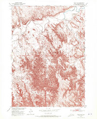
1950 Map of Imlay SE
USGS Topo · Published 1972About this map
Pine Ridge Indian Reservation land dominates this 1950 field-checked survey, revealing a landscape defined by the serpentine path of the White River. The topography is intensely detailed, showing the complex erosion patterns and badlands formations characteristic of the South Dakota plains. Small communal markers are visible against the dramatic terrain, most notably St Barbaras Ch situated near the riverbanks. The drainage system of the region is traced through the winding courses of Medicine Root Creek and Wind Cr, which carve through the reservation's high ridges. This map captures the intersection of natural geography and tribal land boundaries before modern development altered the local infrastructure, offering a clear view of the area's physical state at mid-century.
Find a feature on this map
7 named features on this map. Tap any name to fly to it.
Don’t see what you’re looking for? This feature index may not catch every label — zoom into the map to look around manually.
Map Details
Editions of this 1950 Imlay SE Map
2 editions found
Other maps of this area

1950 · Conata
USGS Topo · 1:24,000

1950 · Conata SW
USGS Topo · 1:24,000

1950 · Imlay SW
USGS Topo · 1:24,000

1950 · Imlay
USGS Topo · 1:24,000

1950 · Imlay SE
USGS Topo · 1:24,000

1950 · Bouquet Table
USGS Topo · 1:24,000

1951 · Sharps Corner
USGS Topo · 1:24,000

1952 · Bouquet Table
USGS Topo · 1:24,000

1952 · Conata
USGS Topo · 1:24,000

1955 · Hot Springs
USGS Topo · 1:250,000