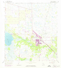
1958 Map of Immokalee
USGS Topo · Published 1974About this map
Immokalee sits at the intersection of agricultural development and the wild Florida interior, captured here during a period of transition in the mid-20th century. The town core is surrounded by an extensive network of drainage and citrus groves, indicated by the numerous Flowing Well labels dotting the landscape. Transport and commerce are anchored by the Seaboard Coast Line railroad and the Immokalee Airport, which define the northern and eastern edges of the settlement.
Find a feature on this map
21 named features on this map. Tap any name to fly to it.
Don’t see what you’re looking for? This feature index may not catch every label — zoom into the map to look around manually.
Map Details
Editions of this 1958 Immokalee Map
3 editions found
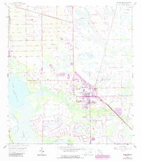
Other maps of this area

1956 · West Palm Beach
USGS Topo · 1:250,000

1957 · West Palm Beach
USGS Topo · 1:250,000

1958 · West Palm Beach
USGS Topo · 1:250,000

1958 · Corkscrew SE
USGS Topo · 1:24,000

1958 · Felda SE
USGS Topo · 1:24,000

1958 · Immokalee
USGS Topo · 1:24,000

1958 · Felda
USGS Topo · 1:24,000

1958 · Sunniland
USGS Topo · 1:24,000

1958 · Immokalee NE
USGS Topo · 1:24,000

1958 · Immokalee SW
USGS Topo · 1:24,000