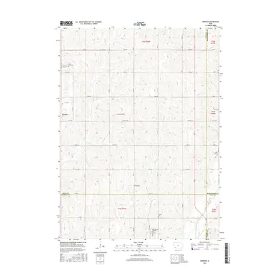
2015 Map of Imogene
USGS Topo · Published 2015About this map
Imogene serves as a focal point in the southwestern corner of this survey, where the township lines of t70n r40w and t70n r39w converge near the border of Fremont and Page Counties. The landscape is defined by the drainage patterns of Walnut Creek and Honey Cr, with the terrain rising into numerous small ridges between these watercourses. Smaller settlements like Strahan and Solomon are connected by a grid of rural routes such as Co Hwy H46 and Co Rd J12. Genealogists will find significant value in the documentation of several family and local burial sites, including the David Farm Cem, Monroe Cem, and South Grove Cem, which reflect the long-standing agricultural heritage of the region across four different county jurisdictions.
Find a feature on this map
38 named features on this map. Tap any name to fly to it.
Don’t see what you’re looking for? This feature index may not catch every label — zoom into the map to look around manually.
Map Details
Editions of this 2015 Imogene Map
This is the sole edition of this map. No revisions or reprints were ever made.
Other maps of this area

1954 · Omaha
USGS Topo · 1:250,000
1955 · Nebraska City
USGS Topo · 1:250,000
1956 · Malvern
USGS Topo · 1:24,000
1957 · Nebraska City
USGS Topo · 1:250,000

1957 · Omaha
USGS Topo · 1:250,000
1957 · Randolph
USGS Topo · 1:24,000
1957 · Tabor NE
USGS Topo · 1:24,000

1958 · Omaha
USGS Topo · 1:250,000
1958 · Nebraska City
USGS Topo · 1:250,000
1978 · Shenandoah East
USGS Topo · 1:24,000