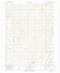
1978 Map of Imogene
USGS Topo · Published 1978About this map
Imogene and Strahan anchor this 1970s agricultural landscape in Southwest Iowa, where the Norfolk and Western railroad cuts a diagonal path across the rolling terrain. The map details a well-established rural network of section lines and watercourses, including the convergence of Honey Creek and Walnut Creek. Cultural landmarks such as Champion Hill Ch and the South Grove Cem reflect the area's genealogical depth, while the Cole Landing Strip and a local substation point to later twentieth-century infrastructure. For those researching family roots or land use, the map clearly delineates township boundaries like Garfield and Pierce, alongside the smaller settlement of Norfolk. The intricate drainage patterns of Indian Creek and Deer Creek reveal the natural topography that shaped the development of Fremont and Mills counties.
Find a feature on this map
18 named features on this map. Tap any name to fly to it.
Don’t see what you’re looking for? This feature index may not catch every label — zoom into the map to look around manually.
Map Details
Editions of this 1978 Imogene Map
This is the sole edition of this map. No revisions or reprints were ever made.
Other maps of this area

1954 · Omaha
USGS Topo · 1:250,000

1955 · Nebraska City
USGS Topo · 1:250,000

1956 · Malvern
USGS Topo · 1:24,000

1957 · Nebraska City
USGS Topo · 1:250,000

1957 · Omaha
USGS Topo · 1:250,000

1957 · Randolph
USGS Topo · 1:24,000

1957 · Tabor NE
USGS Topo · 1:24,000

1958 · Omaha
USGS Topo · 1:250,000

1958 · Nebraska City
USGS Topo · 1:250,000

1978 · Shenandoah East
USGS Topo · 1:24,000