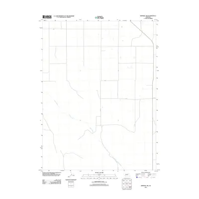
2011 Map of Imperial NW
USGS Topo · Published 2011About this map
Spring Creek meanders through the landscape of northwestern Chase County, cutting a winding path across an otherwise structured agricultural grid. This 2011 survey by the U.S. Geological Survey captures the rural character of the High Plains, where the land is strictly organized by a network of section roads including 750 Rd, 749 Rd, and vertical corridors like 330 Ave. The map reflects a landscape of expansive dryland farming and irrigation, typical of Western Nebraska's agricultural economy at the start of the 21st century. The sparse distribution of named features emphasizes the open, rural nature of this region, where natural drainage systems like the creek provide the primary contrast to the human-imposed geometry of the road system.
Find a feature on this map
6 named features on this map. Tap any name to fly to it.
Don’t see what you’re looking for? This feature index may not catch every label — zoom into the map to look around manually.
Map Details
Editions of this 2011 Imperial NW Map
This is the sole edition of this map. No revisions or reprints were ever made.
Other maps of this area

1954 · McCook
USGS Topo · 1:250,000

1957 · McCook
USGS Topo · 1:250,000

1958 · McCook
USGS Topo · 1:250,000

1961 · Lamar NE
USGS Topo · 1:24,000

1961 · Brandon SE
USGS Topo · 1:24,000
1973 · Chase
USGS Topo · 1:24,000

1973 · Imperial NE
USGS Topo · 1:24,000

1973 · Imperial
USGS Topo · 1:24,000
1973 · Grant
USGS Topo · 1:24,000
1973 · Imperial NW
USGS Topo · 1:24,000