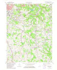
1981 Map of Independence
USGS Topo · Published 1982About this map
Independence serves as the focal point for this Kenton County landscape, situated along a network of winding roads like Stephens Rd and Bristow Road. The topography is defined by the significant meandering of Banklick Creek and Fowler Creek, which carve through the terrain as it transitions from the suburban edges of Covington and Erlanger into more open land. This era shows a community rooted in its institutions, featuring numerous spiritual and educational centers such as St Cecilias Ch, Simon Kenton High Sch, and Banklick Ch.
Find a feature on this map
69 named features on this map. Tap any name to fly to it.
Don’t see what you’re looking for? This feature index may not catch every label — zoom into the map to look around manually.
Map Details
Editions of this 1981 Independence Map
2 editions found
Other maps of this area

1898 · East Cincinnati
USGS Topo · 1:62,500

1914 · East Cincinnati
USGS Topo · 1:62,500

1914 · West Cincinnati
USGS Topo · 1:62,500

1929 · Alexandria
USGS Topo · 1:48,000

1936 · Alexandria
USGS Topo · 1:62,500

1950 · Union
USGS Topo · 1:24,000

1950 · Independence
USGS Topo · 1:24,000

1950 · Verona
USGS Topo · 1:24,000

1950 · Walton
USGS Topo · 1:24,000

1950 · Covington
USGS Topo · 1:24,000