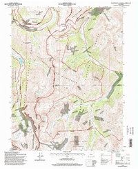
1994 Map of Independence Pass
USGS Topo · Published 1998About this map
Independence Pass serves as the high-altitude centerpiece of this mid-1990s survey, straddling the Continental Divide between the headwaters of the Roaring Fork River and the Arkansas River basin. The landscape is defined by its deep mining heritage and complex water management systems, notably the Twin Lakes Reservoir and Canal Co Tunnel No 1 and the Grizzly Reservoir. While the terrain is dominated by protected areas like the Collegiate Peaks Wilderness and Hunter-Fryingpan Wilderness, the map preserves the locations of early high-country settlements such as Independence, Brumley, and Everett. Geologists and historians can trace the distribution of numerous Mines and Prospects, including the Ruby Mine, which speak to the area's extraction history before its transition to a primarily recreational and wilderness-protected corridor.
Find a feature on this map
47 named features on this map. Tap any name to fly to it.
Don’t see what you’re looking for? This feature index may not catch every label — zoom into the map to look around manually.
Map Details
Editions of this 1994 Independence Pass Map
This is the sole edition of this map. No revisions or reprints were ever made.
Other maps of this area

1889 · Leadville
USGS Topo · 1:125,000

1891 · Leadville
USGS Topo · 1:125,000

1909 · Mount Jackson
USGS Topo · 1:125,000

1911 · Mount Jackson
USGS Topo · 1:125,000

1934 · Taylor Park
USGS Topo · 1:62,500

1935 · Mount Elbert
USGS Topo · 1:62,500

1937 · Taylor Park
USGS Topo · 1:62,500

1938 · Mount Elbert
USGS Topo · 1:62,500

1939 · Mount Elbert
USGS Topo · 1:62,500

1942 · Leadville
USGS Topo · 1:125,000