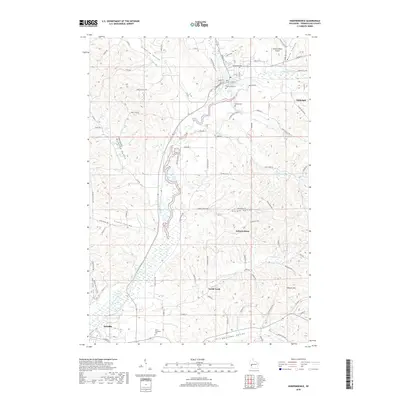
2018 Map of Independence
USGS Topo · Published 2018About this map
The Trempealeau River winds through this section of Wisconsin, anchoring a landscape defined by deep coulees and valley settlements. The city of Independence sits at the heart of the map near Bugle Lake, while the county seat of Whitehall appears to the northeast along the riverbanks. The terrain is marked by distinct family and geographic landmarks such as Traverse Valley, Korpal Valley, and Wickham Valley, illustrating the historic settlement patterns of the region. Local heritage is preserved in sites like Saint Stanislaus Cem near Arcadia and Greenwood Cem in the north. The transportation network, ranging from the Independence Airport to rural routes like Skroch Valley Rd and Pocker Coulee Rd, shows how these communities remain connected across the steep rises of Weaver Hill and the surrounding ridges.
Find a feature on this map
89 named features on this map. Tap any name to fly to it.
Don’t see what you’re looking for? This feature index may not catch every label — zoom into the map to look around manually.
Map Details
Editions of this 2018 Independence Map
This is the sole edition of this map. No revisions or reprints were ever made.
Other maps of this area

1926 · Whitehall
USGS Topo · 1:62,500

1929 · Whitehall
USGS Topo · 1:62,500

1929 · Fountain City
USGS Topo · 1:62,500

1929 · Galesville
USGS Topo · 1:62,500

1932 · Gilmanton
USGS Topo · 1:62,500

1934 · Winona
USGS Topo · 1:62,500

1937 · Winona
USGS Topo · 1:62,500

1953 · Eau Claire
USGS Topo · 1:250,000

1958 · Eau Claire
USGS Topo · 1:250,000

1964 · Eau Claire
USGS Topo · 1:250,000