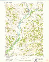
1973 Map of Independence
USGS Topo · Published 1975About this map
Trempealeau River meanders through this portion of western Wisconsin, carving a wide valley floor flanked by distinct coulees and named hollows. The city of Independence serves as a local hub, situated where Bugle L and the river meet, featuring Island Park and a prominent Water Tank near the Green Bay and Western rail line. This transportation corridor follows the river valley southward toward Arcadia, passing the Arcadia Landing Strip and the Arcadia Country Club.
Find a feature on this map
32 named features on this map. Tap any name to fly to it.
Don’t see what you’re looking for? This feature index may not catch every label — zoom into the map to look around manually.
Map Details
Editions of this 1973 Independence Map
This is the sole edition of this map. No revisions or reprints were ever made.
Other maps of this area

1926 · Whitehall
USGS Topo · 1:62,500

1929 · Whitehall
USGS Topo · 1:62,500

1929 · Fountain City
USGS Topo · 1:62,500

1929 · Galesville
USGS Topo · 1:62,500

1932 · Gilmanton
USGS Topo · 1:62,500

1934 · Winona
USGS Topo · 1:62,500

1937 · Winona
USGS Topo · 1:62,500

1953 · Eau Claire
USGS Topo · 1:250,000

1958 · Eau Claire
USGS Topo · 1:250,000

1964 · Eau Claire
USGS Topo · 1:250,000