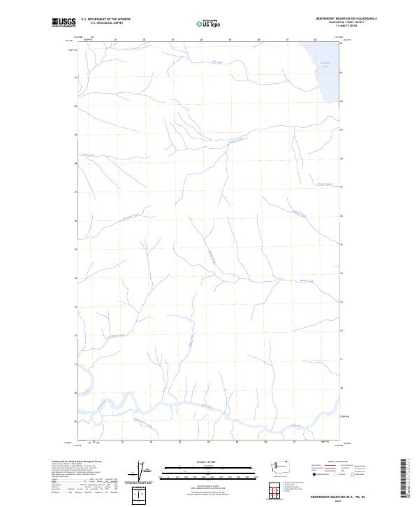
2023 Map of Independent Mountain OE N
USGS Topo · Published 2023About this map
The Kettle River defines the southern reach of this landscape in Ferry County, where the waterway meanders through a valley floor near the international border. This modern 2023 survey by the U.S. Geological Survey illustrates a region dominated by a complex network of drainage basins. Tributaries such as Independent Creek, Gilpin Creek, and Dan O'Rea Creek flow southward to join the river, while the northeastern corner is marked by the presence of Christina Lake. The terrain is characterized by numerous seasonal and perennial streams, including Stewart Creek and Moody Creek, which carve through the elevations of the Colville National Forest area. This map provides a clear record of contemporary hydrography and landform data for a part of the Pacific Northwest where the river system remains the primary geographical anchor.
Find a feature on this map
12 named features on this map. Tap any name to fly to it.
Don’t see what you’re looking for? This feature index may not catch every label — zoom into the map to look around manually.
Map Details
Editions of this 2023 Independent Mountain OE N Map
This is the sole edition of this map. No revisions or reprints were ever made.
Other maps of this area

1936 · Marcus
USGS Topo · 1:96,000

1942 · Marcus
USGS Topo · 1:125,000

1948 · Orient
USGS Topo · 1:62,500

1948 · Togo Mountain
USGS Topo · 1:62,500

1951 · Togo Mountain
USGS Topo · 1:62,500

1951 · Orient
USGS Topo · 1:62,500

1954 · Okanogan
USGS Topo · 1:250,000

1958 · Okanogan
USGS Topo · 1:250,000
1969 · Laurier
USGS Topo · 1:24,000
1983 · Boundary Mtn
USGS Topo · 1:24,000