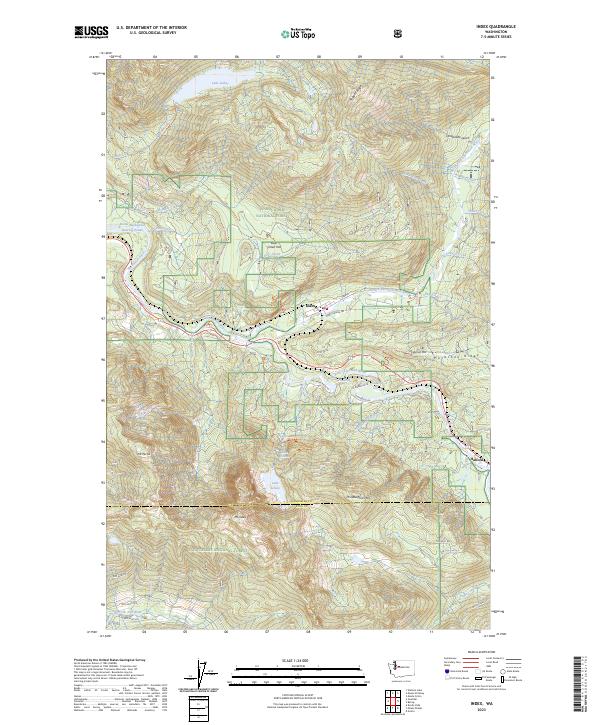
2023 Map of Index
USGS Topo · Published 2023About this map
The Index townsite serves as the primary hub where the North Fork and South Fork Skykomish River converge. This mountain landscape is defined by dramatic elevation changes, centered on the towering profile of Mt Index and the neighboring Mt Persis. Human activity is concentrated along the river corridors and the Index-Galena Rd, which provides access to recreational landmarks such as the Lake Serene Trl and the Heybrook Lookout Trl. Beyond the immediate settlements of Index and Halford, much of the terrain is managed as part of the Snoqualmie National Forest and the Wild Sky Wilderness. Notable water features include the cascading Bridal Veil Falls, Sunset Falls, and Eagle Falls, alongside industrial and conservation-focused sites like the Reiter-Skykomish Rearing Ponds and various Forest Service roads.
Find a feature on this map
56 named features on this map. Tap any name to fly to it.
Don’t see what you’re looking for? This feature index may not catch every label — zoom into the map to look around manually.
Map Details
Editions of this 2023 Index Map
This is the sole edition of this map. No revisions or reprints were ever made.
Other maps of this area

1902 · Skykomish
USGS Topo · 1:125,000

1905 · Skykomish
USGS Topo · 1:125,000

1921 · Sultan
USGS Topo · 1:125,000

1923 · Sultan
USGS Topo · 1:125,000

1957 · Index
USGS Topo · 1:62,500

1957 · Wenatchee
USGS Topo · 1:250,000

1960 · Mount Si
USGS Topo · 1:62,500

1965 · Grotto
USGS Topo · 1:24,000

1965 · Monte Cristo
USGS Topo · 1:24,000
1965 · Baring
USGS Topo · 1:24,000