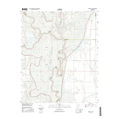
2017 Map of Indian Bay SE
USGS Topo · Published 2017About this map
The White River carves a complex path through this landscape, defining the boundaries where Arkansas, Monroe, and Phillips counties meet. The river's serpentine course has created numerous oxbows and riverine features, such as Big Horseshoe Lake, Little Horseshoe Lake, and the expansive Big Island. This area is dominated by wetlands and intricate water systems, including Big Creek and Oak Bayou, which underscore the region's alluvial character.
Find a feature on this map
65 named features on this map. Tap any name to fly to it.
Don’t see what you’re looking for? This feature index may not catch every label — zoom into the map to look around manually.
Map Details
Editions of this 2017 Indian Bay SE Map
This is the sole edition of this map. No revisions or reprints were ever made.
Other maps of this area

1930 · Mellwood
USGS Topo · 1:62,500

1939 · Modoc
USGS Topo · 1:62,500

1939 · Indian Bay
USGS Topo · 1:62,500

1939 · Henrico
USGS Topo · 1:62,500

1939 · Mellwood
USGS Topo · 1:62,500

1948 · Helena
USGS Topo · 1:250,000

1948 · Modoc
USGS Topo · 1:62,500

1950 · Helena
USGS Topo · 1:250,000

1954 · Mellwood
USGS Topo · 1:62,500

1954 · Indian Bay
USGS Topo · 1:62,500