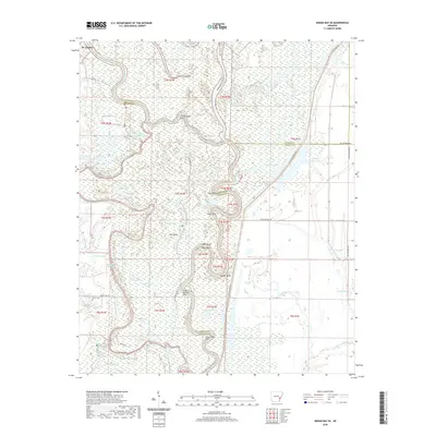
2020 Map of Indian Bay SE
USGS Topo · Published 2020About this map
The White River winds through a dense network of wetlands and oxbow lakes on the border of Arkansas, Monroe, and Phillips Counties in this 2020 survey. Near the settlement of St. Charles, the landscape is defined by the shifting course of the river, which has created numerous distinct water bodies such as Big Island Lake, Little White Lake, and Little Horseshoe Lake. This area is characterized by its intricate hydrography, where secondary waterways like Big Creek and Jessie Slough connect various basins across the low-lying terrain. Local history and genealogy can be traced through several family-named landmarks and secluded burial sites, including Jones Cem and Chute Cem. Roads like Refuge RD and Ethel RD provide limited access to the interior of this watery region, while features like Cottonwood Point and Lone Willow Point serve as prominent markers for those navigating the river bends.
Find a feature on this map
62 named features on this map. Tap any name to fly to it.
Don’t see what you’re looking for? This feature index may not catch every label — zoom into the map to look around manually.
Map Details
Editions of this 2020 Indian Bay SE Map
This is the sole edition of this map. No revisions or reprints were ever made.
Other maps of this area

1930 · Mellwood
USGS Topo · 1:62,500

1939 · Modoc
USGS Topo · 1:62,500

1939 · Indian Bay
USGS Topo · 1:62,500

1939 · Henrico
USGS Topo · 1:62,500

1939 · Mellwood
USGS Topo · 1:62,500

1948 · Helena
USGS Topo · 1:250,000

1948 · Modoc
USGS Topo · 1:62,500

1950 · Helena
USGS Topo · 1:250,000

1954 · Mellwood
USGS Topo · 1:62,500

1954 · Indian Bay
USGS Topo · 1:62,500