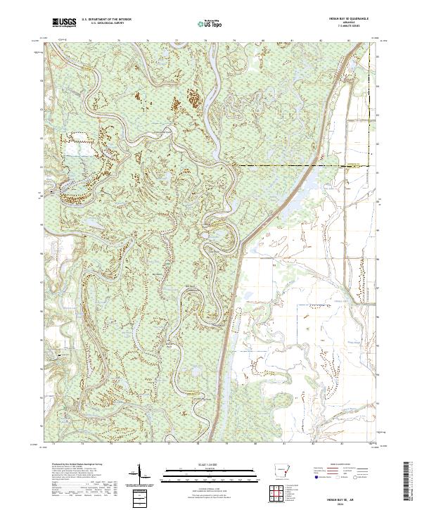
2024 Map of Indian Bay SE
USGS Topo · Published 2024About this map
Dale Bumpers White River National Wildlife Refuge dominates this section of the Arkansas Delta, where the meandering White River forms the natural boundary between Arkansas, Monroe, and Phillips Counties. The landscape is defined by an intricate network of oxbow lakes, sloughs, and chutes, including Big Island Chute which carves around the prominent Big Island. This area remains a preserved sanctuary of bottomland hardwoods and wetlands, reflecting the hydraulic complexity of the White River basin.
Find a feature on this map
62 named features on this map. Tap any name to fly to it.
Don’t see what you’re looking for? This feature index may not catch every label — zoom into the map to look around manually.
Map Details
Editions of this 2024 Indian Bay SE Map
This is the sole edition of this map. No revisions or reprints were ever made.
Other maps of this area

1930 · Mellwood
USGS Topo · 1:62,500

1939 · Modoc
USGS Topo · 1:62,500

1939 · Indian Bay
USGS Topo · 1:62,500

1939 · Henrico
USGS Topo · 1:62,500

1939 · Mellwood
USGS Topo · 1:62,500

1948 · Helena
USGS Topo · 1:250,000

1948 · Modoc
USGS Topo · 1:62,500

1950 · Helena
USGS Topo · 1:250,000

1954 · Mellwood
USGS Topo · 1:62,500

1954 · Indian Bay
USGS Topo · 1:62,500