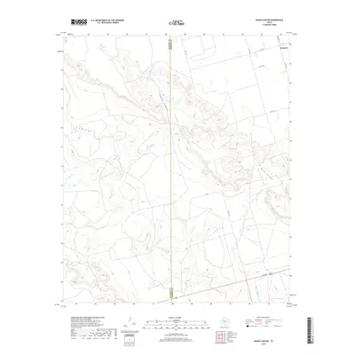
2019 Map of Indian Canyon
USGS Topo · Published 2019About this map
The West Texas landscape at the boundary of Dawson and Borden counties is defined by a network of drainage systems cutting through the plains. The central topographical feature, Indian Canyon, meanders through the center of the sheet, complemented by the similarly carved terrain of Buck Canyon and the T J F Draw to the west. These natural depressions provide the primary relief in an area otherwise characterized by agricultural and ranching tracts.
Find a feature on this map
18 named features on this map. Tap any name to fly to it.
Don’t see what you’re looking for? This feature index may not catch every label — zoom into the map to look around manually.
Map Details
Editions of this 2019 Indian Canyon Map
This is the sole edition of this map. No revisions or reprints were ever made.
Other maps of this area

1954 · Big Spring
USGS Topo · 1:250,000

1958 · Big Spring
USGS Topo · 1:250,000

1968 · Hancock
USGS Topo · 1:24,000

1969 · O'Donnell
USGS Topo · 1:24,000

1969 · Indian Canyon NE
USGS Topo · 1:24,000

1969 · Indian Canyon
USGS Topo · 1:24,000

1969 · Holloway Canyon
USGS Topo · 1:24,000
1970 · Indian Canyon NW
USGS Topo · 1:24,000

1970 · Key
USGS Topo · 1:24,000

1970 · Sand Creek
USGS Topo · 1:24,000