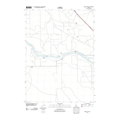
2010 Map of Indian Cove
USGS Topo · Published 2010About this map
The Snake River carves a deep path through this Elmore County landscape, where the small settlement of Indian Cove sits on the southern bank. This 2010 survey illustrates a region defined by high plateaus and canyon drainage, with distinctive landmarks such as Indian Point and Crane Rock rising above the river valley. The infrastructure of the area is anchored by the Indian Cove Bridge and a network of local thoroughfares including Old Highway 30, Pothole Rd, and Billy Rio Loop Rd. The topography north of the river is marked by sharp elevation changes like Chalk Cut and the expanse of Chalk Flat. These geologic features, alongside seasonal drainages like Browns Creek and Dry Creek, show the transition from agricultural river bottoms to the higher arid terrain of Medbury Hill.
Find a feature on this map
21 named features on this map. Tap any name to fly to it.
Don’t see what you’re looking for? This feature index may not catch every label — zoom into the map to look around manually.
Map Details
Editions of this 2010 Indian Cove Map
This is the sole edition of this map. No revisions or reprints were ever made.
Other maps of this area

1892 · Mountain Home
USGS Topo · 1:125,000

1892 · Camas Prairie
USGS Topo · 1:125,000

1893 · Mountain Home
USGS Topo · 1:125,000

1893 · Camas Prairie
USGS Topo · 1:125,000

1947 · Indian Cove
USGS Topo · 1:24,000

1947 · Hammett
USGS Topo · 1:24,000

1947 · Sand Dunes
USGS Topo · 1:24,000

1947 · Hot Spring
USGS Topo · 1:24,000

1948 · Sand Dunes
USGS Topo · 1:24,000

1948 · Hammett
USGS Topo · 1:24,000