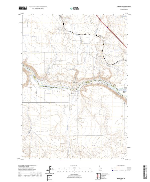
2023 Map of Indian Cove
USGS Topo · Published 2023About this map
The Snake River defines the landscape of this southern Idaho region, carving through the boundary between Elmore and Owyhee counties. This 2023 survey illustrates the dramatic topography of the river valley, where prominent landforms like Indian Point and Medbury Hill overlook the winding watercourse. The area is characterized by a network of drainage features and named depressions, including Browns Gulch and the expansive Indian Cove, which give the quadrangle its name. Human activity is represented by a series of local roads and tracks such as Johnson Drag and Hodco Rd, reflecting the sparse but enduring presence of ranching and agriculture near the river. Downstream, Sparlin Island sits in the channel, while geological interest is highlighted by features like Chalk Cut and Chalk Flat, indicating the distinct white sediments of the high desert terrain.
Find a feature on this map
28 named features on this map. Tap any name to fly to it.
Don’t see what you’re looking for? This feature index may not catch every label — zoom into the map to look around manually.
Map Details
Editions of this 2023 Indian Cove Map
This is the sole edition of this map. No revisions or reprints were ever made.
Other maps of this area

1892 · Mountain Home
USGS Topo · 1:125,000

1892 · Camas Prairie
USGS Topo · 1:125,000

1893 · Mountain Home
USGS Topo · 1:125,000

1893 · Camas Prairie
USGS Topo · 1:125,000

1947 · Indian Cove
USGS Topo · 1:24,000

1947 · Hammett
USGS Topo · 1:24,000

1947 · Sand Dunes
USGS Topo · 1:24,000

1947 · Hot Spring
USGS Topo · 1:24,000

1948 · Sand Dunes
USGS Topo · 1:24,000

1948 · Hammett
USGS Topo · 1:24,000