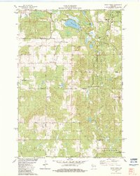
1982 Map of Indian Creek
USGS Topo · Published 1983About this map
Indian Creek serves as a central point in this rural landscape at the intersection of Lorain, La Follette, Dewey, and McKinley townships. The map documents a territory defined by glacial water features and conservation efforts, notably the Clam River State Fishery Area and the Sand Creek State Fishery Area. Large water bodies like Spencer Lake and Little Bass Lake dominate the northern terrain, while the North Fork Clam River and Bashaw Outlet weave through the lowland areas.
Find a feature on this map
35 named features on this map. Tap any name to fly to it.
Don’t see what you’re looking for? This feature index may not catch every label — zoom into the map to look around manually.
Map Details
Editions of this 1982 Indian Creek Map
This is the sole edition of this map. No revisions or reprints were ever made.
Other maps of this area

1949 · Hertel
USGS Topo · 1:48,000

1950 · Webster
USGS Topo · 1:48,000

1951 · Cumberland
USGS Topo · 1:48,000

1951 · Frederic
USGS Topo · 1:48,000

1953 · Stillwater
USGS Topo · 1:250,000

1955 · Hertel
USGS Topo · 1:62,500

1955 · Webster
USGS Topo · 1:62,500

1955 · Frederic
USGS Topo · 1:62,500

1955 · Stillwater
USGS Topo · 1:250,000

1956 · Cumberland
USGS Topo · 1:62,500