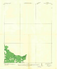
1935 Map of Indian Gap
USGS Topo · Published 1935About this map
Indian Mountain dominates the southwestern corner of this survey, where the Tennessee Valley Authority and USGS collaborated on an advance topographic study in the mid-1930s. The landscape is defined by the industrial presence of the Clinchfield Coal No 14 mine, positioned near the small settlements of Glamorgan and Vickers. This map focuses on the high-elevation terrain near Indian Gap, showing the early footprint of Highway No 23 as it cuts through the ridges. Local community life is anchored by the Gilliam Sch, while the drainage of Rocky Fork and Yellow Creek provides a natural framework for the coal-producing hollows of Wise County. Because this is an advance sheet based on aerial photography and field examinations by engineers like Albert Pike, it provides a precise look at the infrastructure of the Clinchfield Coal Corporation.
Find a feature on this map
10 named features on this map. Tap any name to fly to it.
Don’t see what you’re looking for? This feature index may not catch every label — zoom into the map to look around manually.
Map Details
Editions of this 1935 Indian Gap Map
This is the sole edition of this map. No revisions or reprints were ever made.
Other maps of this area

1886 · Grundy
USGS Topo · 1:125,000

1890 · Whitesburg
USGS Topo · 1:125,000

1890 · Grundy
USGS Topo · 1:125,000

1892 · Grundy
USGS Topo · 1:125,000

1892 · Whitesburg
USGS Topo · 1:125,000

1894 · Estillville
USGS Topo · 1:125,000

1897 · Bristol
USGS Topo · 1:125,000

1902 · Bristol
USGS Topo · 1:125,000

1912 · Pound
USGS Topo · 1:48,000

1913 · Clintwood
USGS Topo · 1:62,500