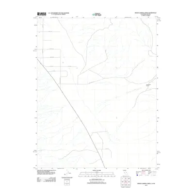
2012 Map of Indian Garden Creek
USGS Topo · Published 2012About this map
Indian Garden Cr flows through this high-desert landscape in Esmeralda County, providing a rare water source in an area defined by its arid drainage systems. The terrain is marked by the significant geographic feature of White Wolf Canyon (also labeled White Wolf Cyn), which carves through the eastern portion of the quadrangle. The local infrastructure consists of a rectilinear grid of dirt roads and tracks, including Windmill Rd, Wright Rd, and Serfoss Dr, suggesting a history of ranching or remote land division. The intersection of White Mountain Rd and Hi Bar Rd serves as a central point for navigating this sparsely populated territory on the California-Nevada border.
Find a feature on this map
12 named features on this map. Tap any name to fly to it.
Don’t see what you’re looking for? This feature index may not catch every label — zoom into the map to look around manually.
Map Details
Editions of this 2012 Indian Garden Creek Map
This is the sole edition of this map. No revisions or reprints were ever made.
Other maps of this area

1898 · Silver Peak
USGS Topo · 1:125,000

1900 · Silver Peak
USGS Topo · 1:125,000

1908 · Lida
USGS Topo · 1:250,000

1913 · Bishop
USGS Topo · 1:125,000

1913 · Lida
USGS Topo · 1:250,000

1917 · White Mountain
USGS Topo · 1:125,000

1947 · Mariposa
USGS Topo · 1:250,000

1948 · Mariposa
USGS Topo · 1:250,000

1951 · Blanco Mountain
USGS Topo · 1:62,500

1954 · Goldfield
USGS Topo · 1:250,000