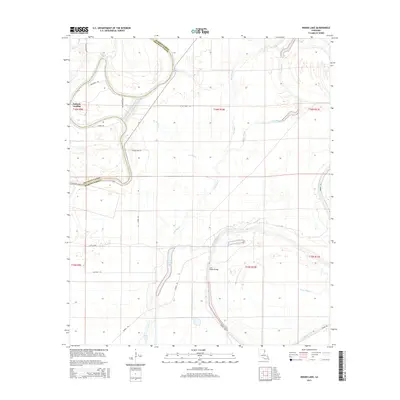
2015 Map of Indian Lake
USGS Topo · Published 2015About this map
Jackson Landing and Butler Landing mark the meandering course of Bayou Macon along the boundary of Madison and Franklin Parishes. This landscape is defined by the complex hydrography of the Lower Mississippi Valley, featuring an intricate network of waterways including Indian Lake, Chain Lake, and the Tensas River. The transition from old river bends to modern water management is evident in features like Bakers Cut-off and the various bayous—Lick Bayou, Dry Bayou, and Sutt Bayou—that drain the low-lying terrain.
Find a feature on this map
30 named features on this map. Tap any name to fly to it.
Don’t see what you’re looking for? This feature index may not catch every label — zoom into the map to look around manually.
Map Details
Editions of this 2015 Indian Lake Map
This is the sole edition of this map. No revisions or reprints were ever made.
Other maps of this area

1935 · Winnsboro
USGS Topo · 1:62,500

1935 · Baskinton
USGS Topo · 1:62,500

1935 · Waverly
USGS Topo · 1:62,500

1935 · Shackleford Lake
USGS Topo · 1:62,500

1955 · Jackson
USGS Topo · 1:250,000

1958 · Baskinton
USGS Topo · 1:62,500

1958 · Shackleford Lake
USGS Topo · 1:62,500

1958 · Winnsboro
USGS Topo · 1:62,500

1961 · Jackson
USGS Topo · 1:250,000

1961 · Waverly
USGS Topo · 1:62,500