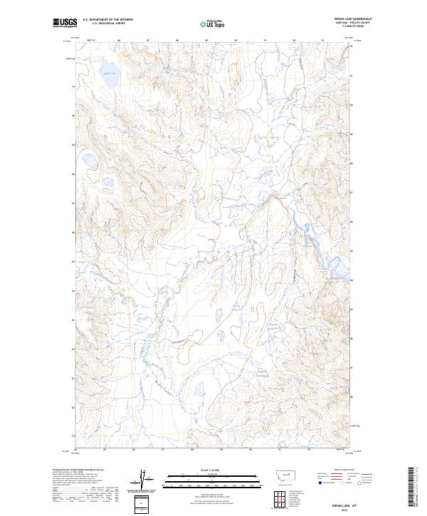
2024 Map of Indian Lake
USGS Topo · Published 2024About this map
Ul Bend National Wildlife Refuge and the Charles M Russell National Wildlife Refuge dominate this part of Phillips County, where the landscape is defined by complex drainage systems and conservation lands. The terrain is marked by numerous coulees and creeks, including the winding path of Fourchette Creek and Mickey Coulee, which highlight the natural erosion patterns of the Missouri River breaks region.
Find a feature on this map
20 named features on this map. Tap any name to fly to it.
Don’t see what you’re looking for? This feature index may not catch every label — zoom into the map to look around manually.
Map Details
Editions of this 2024 Indian Lake Map
This is the sole edition of this map. No revisions or reprints were ever made.
Other maps of this area

1954 · Jordan
USGS Topo · 1:250,000

1956 · Jordan
USGS Topo · 1:250,000

1958 · Jordan
USGS Topo · 1:250,000

1964 · Jordan
USGS Topo · 1:250,000

1965 · Lost Creek
USGS Topo · 1:24,000

1965 · Sun Prairie
USGS Topo · 1:24,000

1965 · Herman Point
USGS Topo · 1:24,000

1965 · Locke Ranch
USGS Topo · 1:24,000
1965 · Mickey Butte
USGS Topo · 1:24,000
1965 · Stratton Reservoir
USGS Topo · 1:24,000