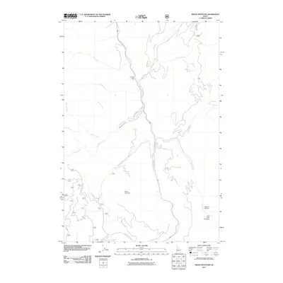
2011 Map of Indian Mountain
USGS Topo · Published 2011About this map
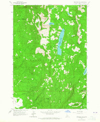
The Little Salmon River carves through the Idaho backcountry, forming a central corridor for transport and drainage in this high-altitude landscape. Along its banks, the Fall Creek Access Area serves as a key point of entry for the surrounding wilderness, where the river meets Fall Creek. The terrain is defined by dramatic elevation changes, rising from the river valley toward the summit of Indian Mountain. Forest Service roads like Smokey Boulder Rd and Hillman Basin Rd provide access to remote landmarks such as Tepee Springs and the Hard Creek meadows. This area is characterized by its numerous water features, including Hazard Falls and the deep cut of Bascom Canyon, illustrating the complex drainage patterns that shape the Payette National Forest region.
Find a feature on this map
28 named features on this map. Tap any name to fly to it.
Don’t see what you’re looking for? This feature index may not catch every label — zoom into the map to look around manually.
Map Details
Editions of this 2011 Indian Mountain Map
This is the sole edition of this map. No revisions or reprints were ever made.
Other maps of this area

1938 · Riggins
USGS Topo · 1:96,000

1945 · Riggins
USGS Topo · 1:125,000

1955 · Grangeville
USGS Topo · 1:250,000

1959 · Grangeville
USGS Topo · 1:250,000

1963 · Bally Mountain
USGS Topo · 1:24,000

1963 · Indian Mountain
USGS Topo · 1:24,000
1963 · Railroad Saddle
USGS Topo · 1:24,000
1963 · Hazard Lake
USGS Topo · 1:24,000
1963 · Pollock Mountain
USGS Topo · 1:24,000
1963 · Brundage Mtn
USGS Topo · 1:24,000